fbpx
Skip to content Skip to footer

Our County

About Horry County

Horry County, South Carolina
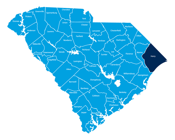
Horry County covers over 1130 square miles, making it the largest of South Carolina’s 46 counties. The vast Horry County landscape includes forests, fields, farms, marshes, swamps, the famed “black water” rivers, and miles of unspoiled coastline. In 1785, the area became a full political subdivision when the Georgetown district was divided into four separate counties. It is named after South Carolina native and Revolutionary War hero, Peter Horry (pronounced “oh-ree” with a silent “H”).

Horry County was incorporated in 1801. During the eighteenth and early nineteenth centuries, the primary industries in the area included lumber and naval stores — with tobacco farming introduced later. The county’s coastal and inland beauty has driven the growth of development and a huge economy based on tourism, outdoor recreation, and commercial fishing. Because of the county’s coastal beauty, tourism has come to dominate the areas around the city of Myrtle Beach and North Myrtle Beach, generating nearly a half billion dollars of tax revenue for South Carolina each year.

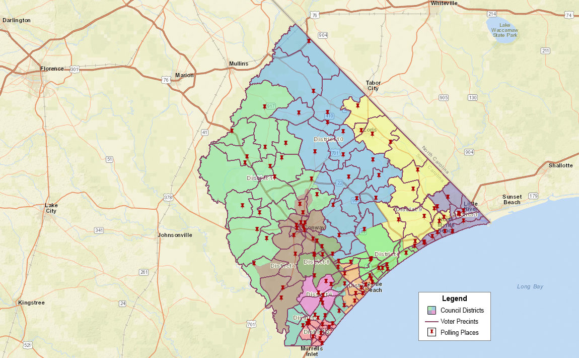
The county seat is centrally located in the City of Conway. The governing body is the Horry County Council, composed of 11 single-member districts and a County Chair elected at-large. The Chair and each Councilmember serve terms of four years. The Council usually meets on the first and third Tuesday of every month at 6:00 pm in the Council Chambers at the Horry County Government and Justice Center – located at 1301 2nd Avenue in Conway.

Horry County Council Districts/Voter Precincts

Horry County Council Districts/Voter Precincts

Horry County Council Districts

District 1

covers Atlantic Beach, Brooksville, Little River, and North Myrtle Beach

District 2

includes the City of Myrtle Beach north from 38th Avenue North, Briarcliffe Acres, Carolina Forest borded by Augusta Plantation Road and Carolina Forest Boulevard, and Nixonville along Highway 90

District 3

covers the heart of Myrtle Beach south to the airport and state park, and extends west into Carolina Forest

District 4

includes the southern section of Forestbrook, The Market Common, Prestwick, Deerfield and Southwood along Highway 544, across 17 Bypass to parts of Socastee, Marlowe, and Burgess south to the county line

District 5

contains Surfside Beach, Garden City and the Burgess area bordered by Holmestown Road, Highway 707 and Tournament Boulevard

District 6

covers Socastee along Highway 544 and the surrounding area

District 7

includes Conway and the surrounding area, south to Bucksport and the county line

District 8

includes Forestbrook and Carolina Forest areas straddling US 501

District 9

extends west from North Myrtle Beach to Longs and Loris along Highway 9 and the North Carolina border

District 10

covers a massive area north from Carolina Forest to the Lumber River and the North Carolina border

District 11

includes Aynor, Galivants Ferry, and Red Hill – running west to the county line

Horry County Cities

Conway (county seat)

Loris

Myrtle Beach

North Myrtle Beach

Horry County Cities

Atlantic Beach

Aynor

Briarcliffe Acres

Surfside Beach

Census-Designated

Bucksport

Forestbrook

Garden City

Little River

Red Hill

Socastee

Unincorporated Communities in Horry County

Adrian
Allsbrook
Baxter Forks
Bayboro
Brooksville
Bucksville
Burgess
Carolina Forest
Causey
Cedar Branch
Cherry Grove

Cool Spring
Crescent Beach
Daisy
Dongola
Duford
Floyds
Galivants Ferry
Glass Hill
Green Sea
Gurley
Hand

Hickory Grove
Homewood
Ingram Beach
Jordanville
Ketchuptown
Klondike
Konig
Little Town
Longs
Loris
Nixonville

Nixons Crossroads
Ocean Drive Beach
Pine Island
Polecat Landing
Poplar
Red Bluff Crossroads
Shell
Springmaid Beach
Toddville
Wampee
Windy Hill

As of the 2010 Census, all of Horry County is in U.S. Congressional Disctrict 7

Copyright ©2024 Horry County Democrats. All rights reserved. Sitemap | Privacy Policy | Comment & Posting Policy